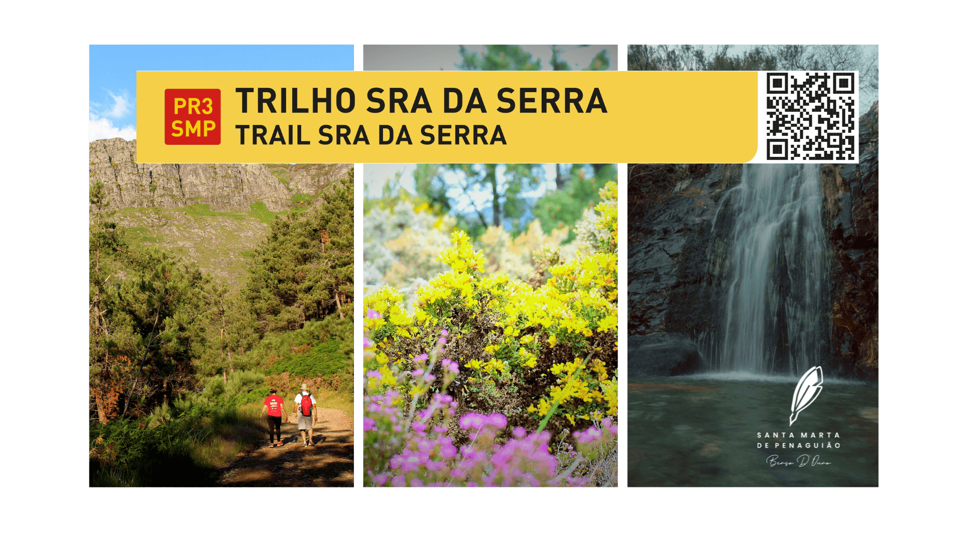
PR3 SMP Trilho Sra. da Serra

To save the location as a favorite, you need to have an account
LoginNew around here? Let s go create an account
Description
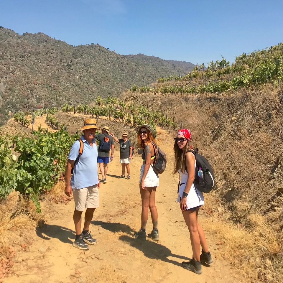
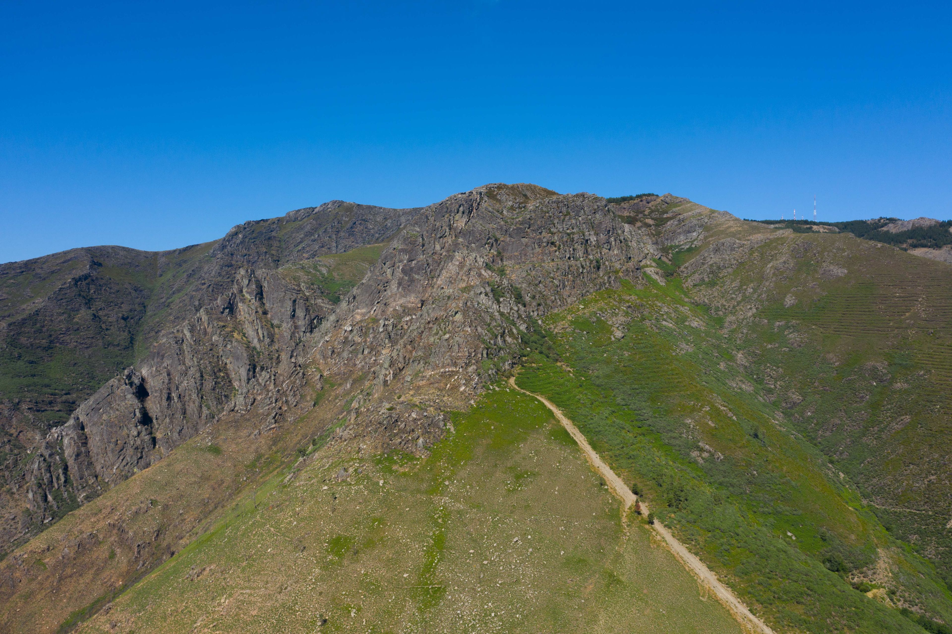
The Senhora da Serra trail is about 13,7km long and is part of the Santa Marta de Penaguião Municipal Network of Pedestrian Routes. The trail starts at the Soutelo Chapel and goes through the highest part of Vila de Fontes, located in the heart of Serra do Marão. It is a cobbled path bordered by several specimens of native vegetation characteristic of this region: Ulex europaeus, Erica, Baccharis trimera. It is an ascending path through forest paths and dense pine forests, seeing here and there ravines and escarpments of the Marão. At the top of the path, at an altitude of 1416 meters, stands the chapel of Senhora da Serra do Marão, whose pilgrimage is known to be the highest in Portugal. It is a trail that gives us two characteristic and distinct landscapes of Santa Marta de Penaguião: the beauty of the Serra do Marão and the vineyards.
Located in Serra do Marão, this trail is one of the most beautiful at the landscape and natural level, rich in flora and fauna, we can find, among others, several specimens of flowers and plants: Crocus carpetanus, Fritillaria nervosa, Hieracium amplexicaule, Murbeckiella sousae, Platanthera bifolia, Scilla verna, Scorzonera humilis, Tuberaria globulariifolia, Sorbus torminalis, Vaccinium myrtillus (blueberry). Passing through streams, pine forests and intense landscapes with accentuated unevenness, we can see the typical Douro wine region terraced vineyards. By the echoes and sounds shaped by nature we can find the waterfalls between the towns of Soutelo and Póvoa da Serra.
Kms per day
Day 1 -
- Capela de São João
- Capela de Santa Maria Madalena
- Quedas de Água
- Curva do Eco
- Capela Senhora da Serra
- Marco Geodésico do Marão
Recommendations
The summit of Fraga da Ermida, formerly known as Monte de Penaguião (hill of Penaguião), is at an altitude of 1.397m.
Not being the highest point of the mountain, the landscape that can be seen from this ridge helps to clearly understand the reason for the expression "Para cá do Marão, mandam os que cá estão” (“in this side of Marão, rule those who are here").
This mountain range was the obstacle that separated the Minho (on the coast) from the territory which, because it was so difficult to cross, offered the lands to the west of this orographic accident the designation of Trás-los-Montes (behind the hills). The steep and huge slopes were, until the 19th century, a natural obstacle for traveling: in addition to the bumpy terrain, the harsh winters and the many robbers who waited at every turn made these journeys difficult and dangerous.
From 1880, it became possible to go from Trás-os-Montes to Minho by train. The trip was then less time-consuming, but its cost was too high for most people beyond Marão, mostly agricultural workers in the many vineyards of the Douro Vinhateiro region.
Tips
The low vegetation, difficult relief and human activities have caused a great impact on the number of species and headcount in each species.
The Iberian wolf (Canis lupus signatus), a species once hunted in large numbers on the day of St. John, has been regaining its territory, but is still a priority species, which remains in danger of extinction.
Other endangered species in this habitat are the golden eagle (Aquila chrysaetos), with a single couple nesting in the territory, and the Schreibers’ bent-winged bat (Miniopterus schreibersii), a species threatened in Portugal and referred to as a species at risk of collision with wind turbines.
Among the most frequent birds are the pallid swift (Apus pallidus), the common buzzard (Buteo buteo) and the chaffinch (Fringilla coelebs). The wallcreeper (Tichodroma muraria), considered one of the rarest birds in Portugal, was spotted on the escarpments of the fraga in December 2015.
.
No. of people:
Total days:
1Total kilometres:
13.7 KmTotal Points of Interest:
2Points of interest on this itinerary